Tackling nearshore challenges
Eric Zon, Lankelma Managing Director.
Meeting the challenges of nearshore geotechnical investigations requires specialist input, not simply a transfer of land-based techniques to the marine environment.

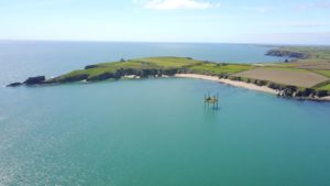
Like any engineering project, those being built in nearshore environments (in water depths of less than 20m) – such as ports, pipelines, cables and coastal defences – rely on good quality geotechnical and sample data to provide ground information for initial project planning and consent applications, right through to detailed engineering and design.
However, consultants involved in nearshore projects often look to the onshore geotechnical sector to acquire data. This can result in site investigations using effectively “land-based” techniques on the beach and foreshore, both challenging tidal environments, and over water, typically from jack-up platforms.
This may not always be cost-effective or appropriate and can result in higher investigation costs and increased engineering risk.
Unique challenges
Nearshore investigations have their own set of challenges, not least the cost: mobilisation can be up to 20 times more than land-based investigations. A full compliment of jack-up platform, drill and CPT rig, welfare units, inflatable boat and crane can take up to 11 low loaders to mobilise and require a 100 tonne crane to put it all together. Operations can cost ten times as much per metre as land work, due to the high cost of the marine plant involved and the lower productivity.
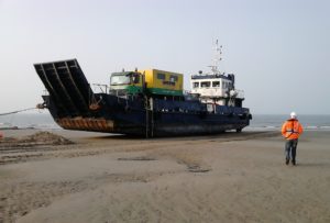
And, while marine investigations normally run 24 hours-a-day in the nearshore (on beaches and in ports and harbours), teams also have to deal with local residents, so working hours can be restricted. This means expensive equipment, such as jack-up barges (which are normally charged out per 24 hours) can potentially only be used for 10 or 12 hours a day, increasing the cost per position further.
Even with 24-hour working, productivity can be half that of onshore work, due to the logistics of moving between positions; working with the tides and marine traffic and dealing with the weather. Using techniques such as cone penetration testing can, on the other hand, significantly speed-up data collection.
Weather is a particular challenge. Weather down-time on land is negligible but in the marine environment it is not only the movement of the jack-up platform that can be restricted by bad weather but it can also cause issues for getting staff on- and off-board, which might mean abandoning the platform before bad weather hits.
Investigations also need to be carried out in conjunction with environmental and habitat assessments; unexploded ordnance studies; geophysical and hydrographic surveys; ground modelling; volume assessments and foundation design. This integrated approach typically improves data quality and cost-effectiveness significantly.
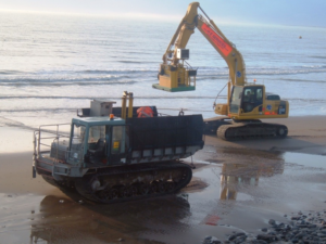
There are a number techniques for acquiring geotechnical, geochemical or geological data in nearshore environments other than from fixed platforms, from seabed penetrometer systems (for insitu CPT); to small mini-vibrocores for use on local vessels; standard and heavy duty vibrocorers; underwater rock drills, grab samplers and seabed probes. This marine equipment can also be deployed from a crane on a quayside or from the shoreline, saving costs, but is then often only suitable for shallower investigations.
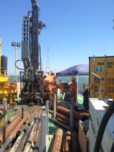
When operated from nearshore survey vessels and platforms, these systems will result in significant time savings, compared with land-based systems mounted on a jack-up or barge.
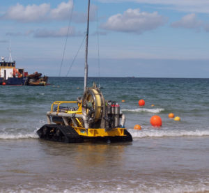
For example, a seabed penetrometer system or vibrocore rig can be mounted on a small multi-cat type vessel. These flat-bottomed craft have a shallow draft, making them ideal for very shallow water. And, as seabed-deployed geotechnical equipment is usually not on the seabed for more than 30 minutes, it is possible to access intertidal areas on a rising tide.
Employing specialist marine techniques for nearshore investigations should result in improved and optimised data acquisition for projects. When processed and modelled by engineers specialising in marine geotechnics and geology, this approach will help ensure surveys fully meet the project objectives, and ensure they are completed in a safe, timely and cost-effective way.
We’re here to help
We are always looking at new ways to help clients and partners, so please get in touch if you want to discuss how we can work together to share ideas and develop solutions to your geotechnical challenges.